Dataset Analysis
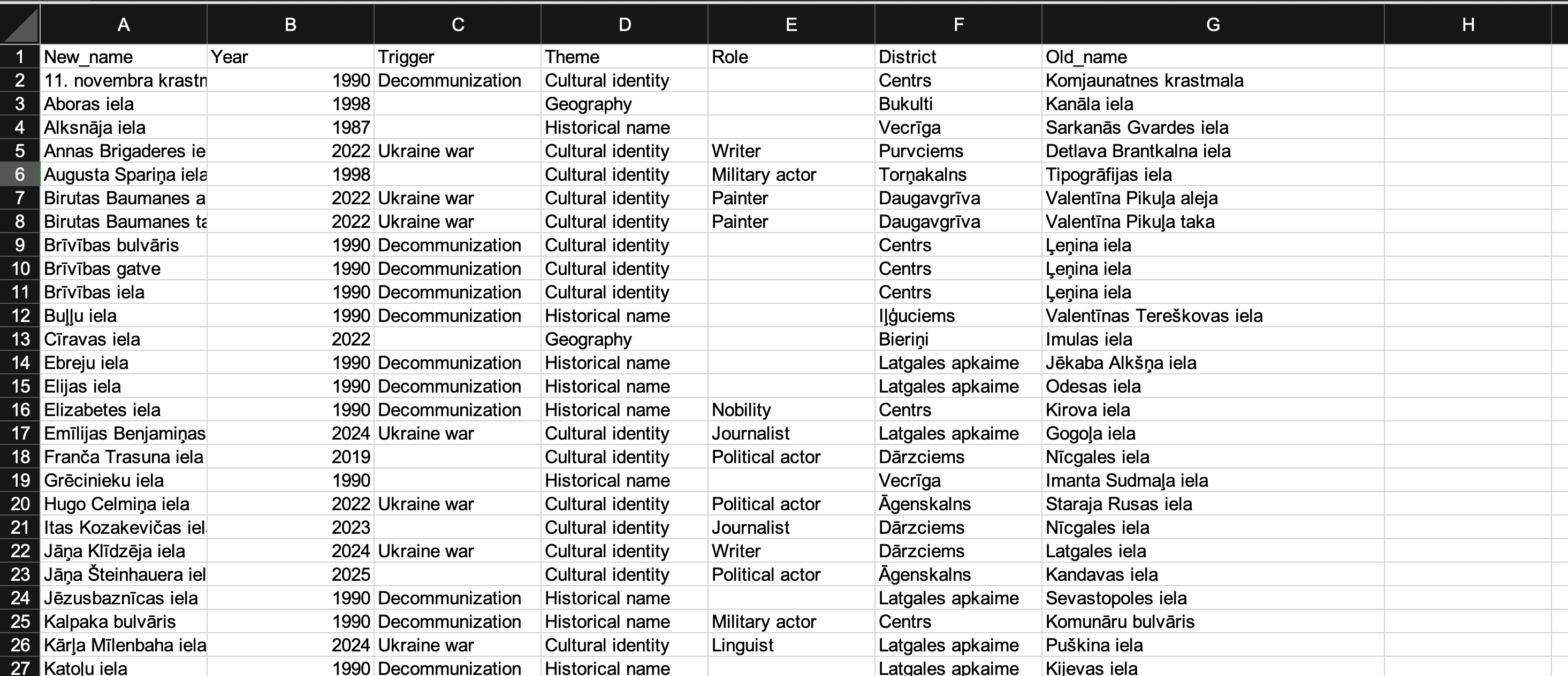
To implement the project, a specialized dataset was created and processed, reflecting the process of street renaming in Riga from 1990 to 2025. This data array became the basis for analysis, visualization and construction of an interactive map, allowing to trace how the city’s toponymy has changed over more than three decades.
The information was collected from various reliable sources, including regulatory acts of the Riga City Council, publications in the official publication Latvijas Vēstnesis, historical reference books, archival documents, as well as materials from Latvijas Valsts vēstures arhīvs. Additional information was obtained from public digital databases and media archives covering events that influenced changes in the city’s symbolism.
The final version of the dataset included 56 cases of street renaming. For each entry, a pair of the old and new name was recorded, the year of the change was indicated, and event triggers such as decommunization, geopolitical conflicts, or cultural initiatives were recorded. Thematic categories related to the motives for renaming (e.g. cultural identity, memory, geography), and the occupation or social status of the people after whom the streets were named were also reflected. The city district where the change took place was also indicated.
The collected data were used for geocoding, which made it possible to build a visual model reflecting where and when renaming took place, which districts were subject to changes most often, and how this is related to specific historical events. Thus, the dataset became the main tool for studying symbolic transformations in the urban environment of Riga.